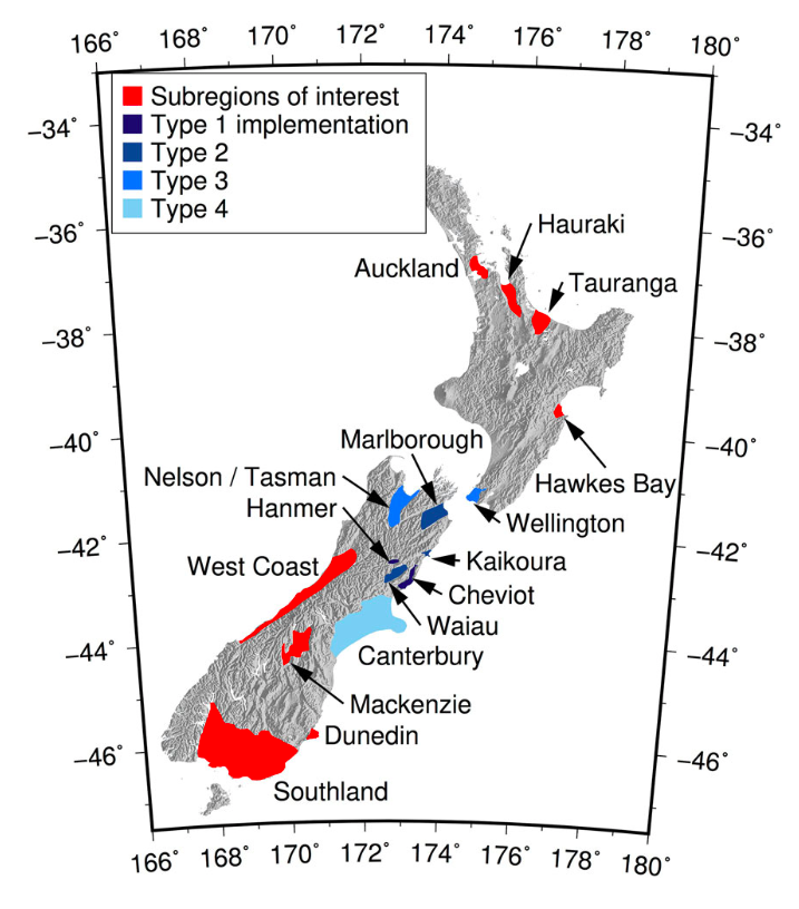
This page is to document what basins have been modelled throughout NZ and the type of the model
| Type | Classification |
|---|---|
| 1 | Based on geological maps and DEMs |
| 2 | Refined based on additonal data
|
| 3 | Further development of type 2 |
| 4 | Extensive datasets with advanced modelling |
Basins in GeoTIFF format (v2.07 including 34 basins) : Download
Notes: Only VM Versions 2+ are included
| Version Included | Author | Date Added | Basin | Type | Status | Notes and Outline Images |
|---|---|---|---|---|---|---|
South Island | ||||||
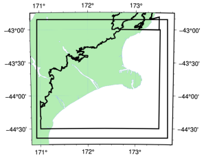
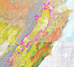
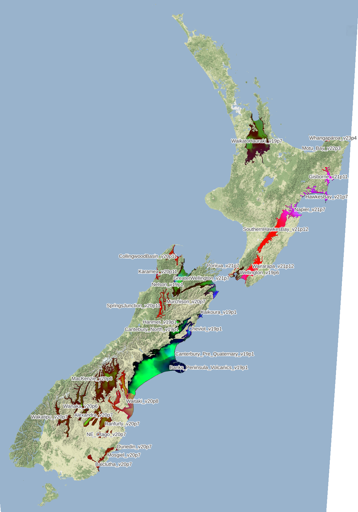
| 2.01+ | Robin | updated 19p1 | Canterbury | 4 | Comprehensive Includes Waipara Waikari is within the cheviot bounds |
|
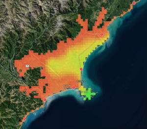
| 2.01+ | Ethan | 19p1 | Cheviot | 1 |
| |
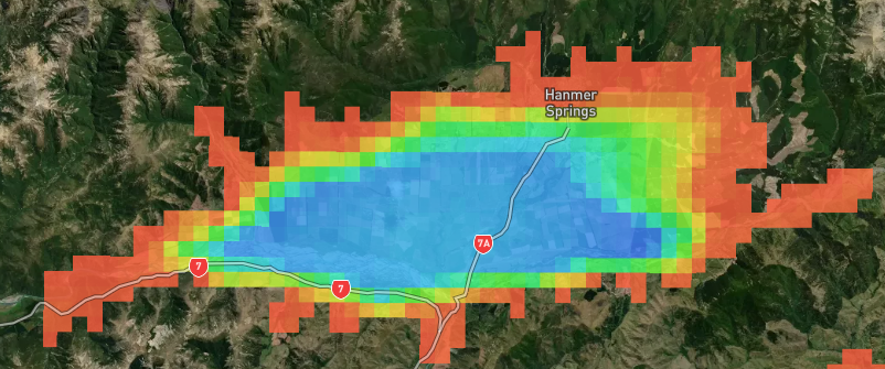
| 2.01+ | Ethan | 19p1 | Hanmer | 2 | (check extent to make sure it covers the whole area) |
|
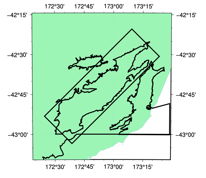
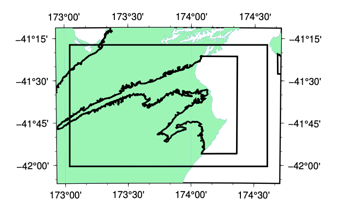
| 2.01+ | Ethan | 19p1 | Kaikoura | 2 |
| |
| 2.01+ | Ethan | 19p1 | Marlborough | 2 |
| |
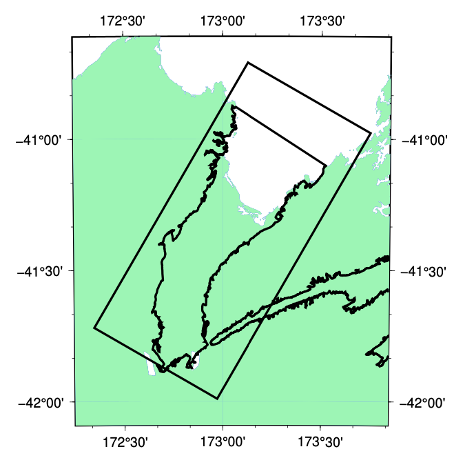
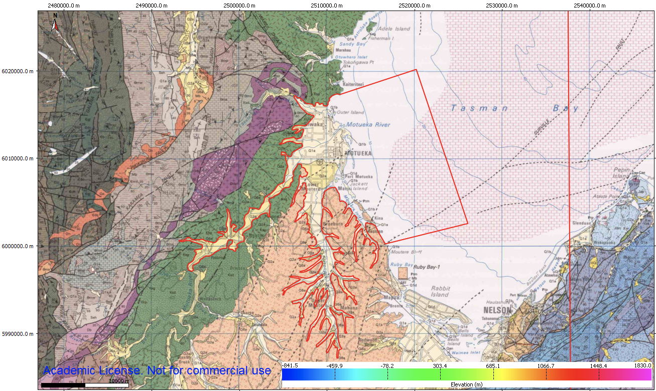
| 2.01+ | Ethan | 19p1 | Nelson/Tasman | 2 |
https://nelson-richmond-geolmap.github.io/RGMap/ (for the geological map of the Nelson-Richmond area) | |
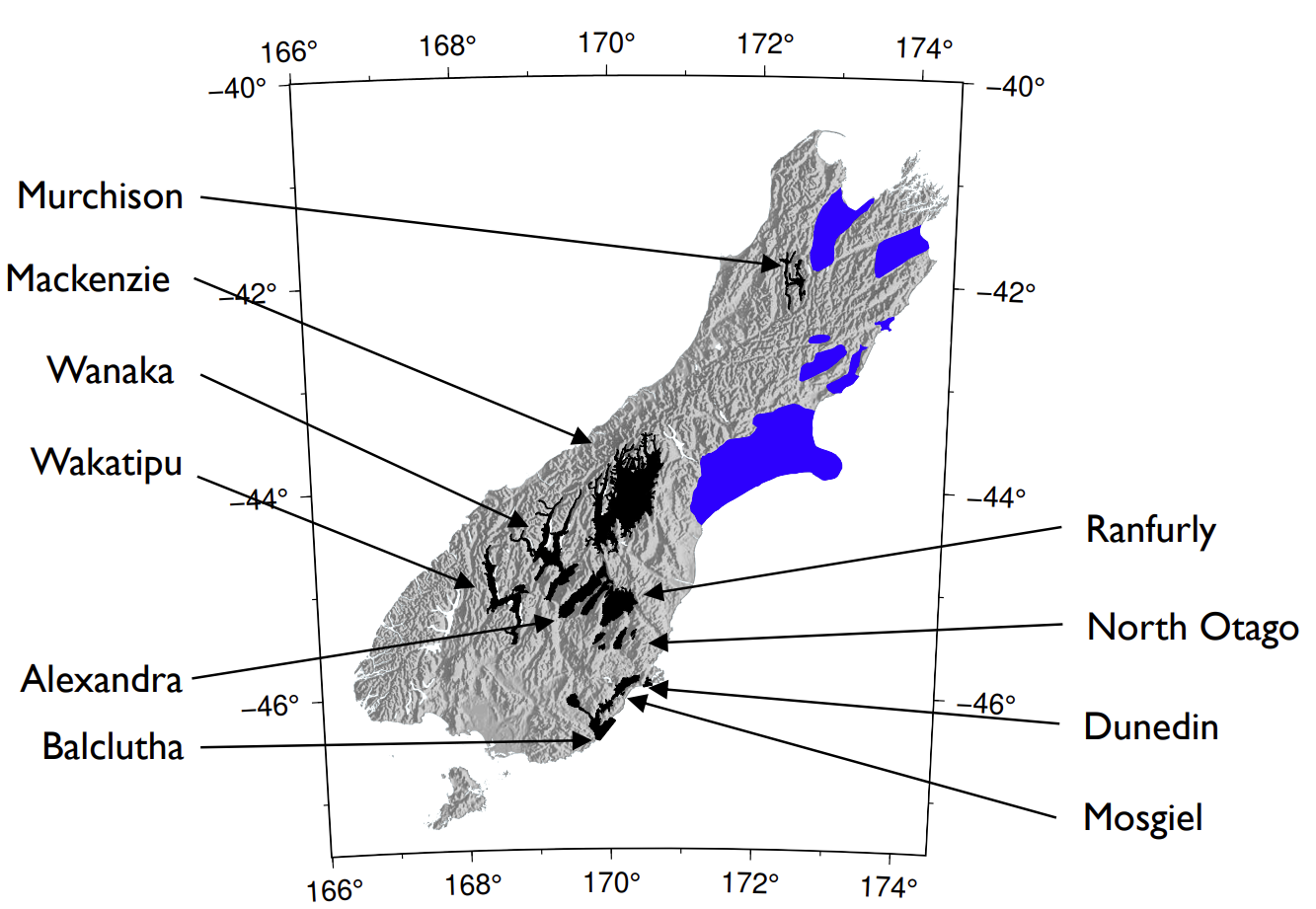
| 2.04+ | Cameron Douglas | 20p6 | Wanaka | 1 | USER 2020 - Integrated |
|
| 2.04+ | Cameron Douglas | 20p6 | Mackenzie | 1 | USER 2020 - Integrated |
|
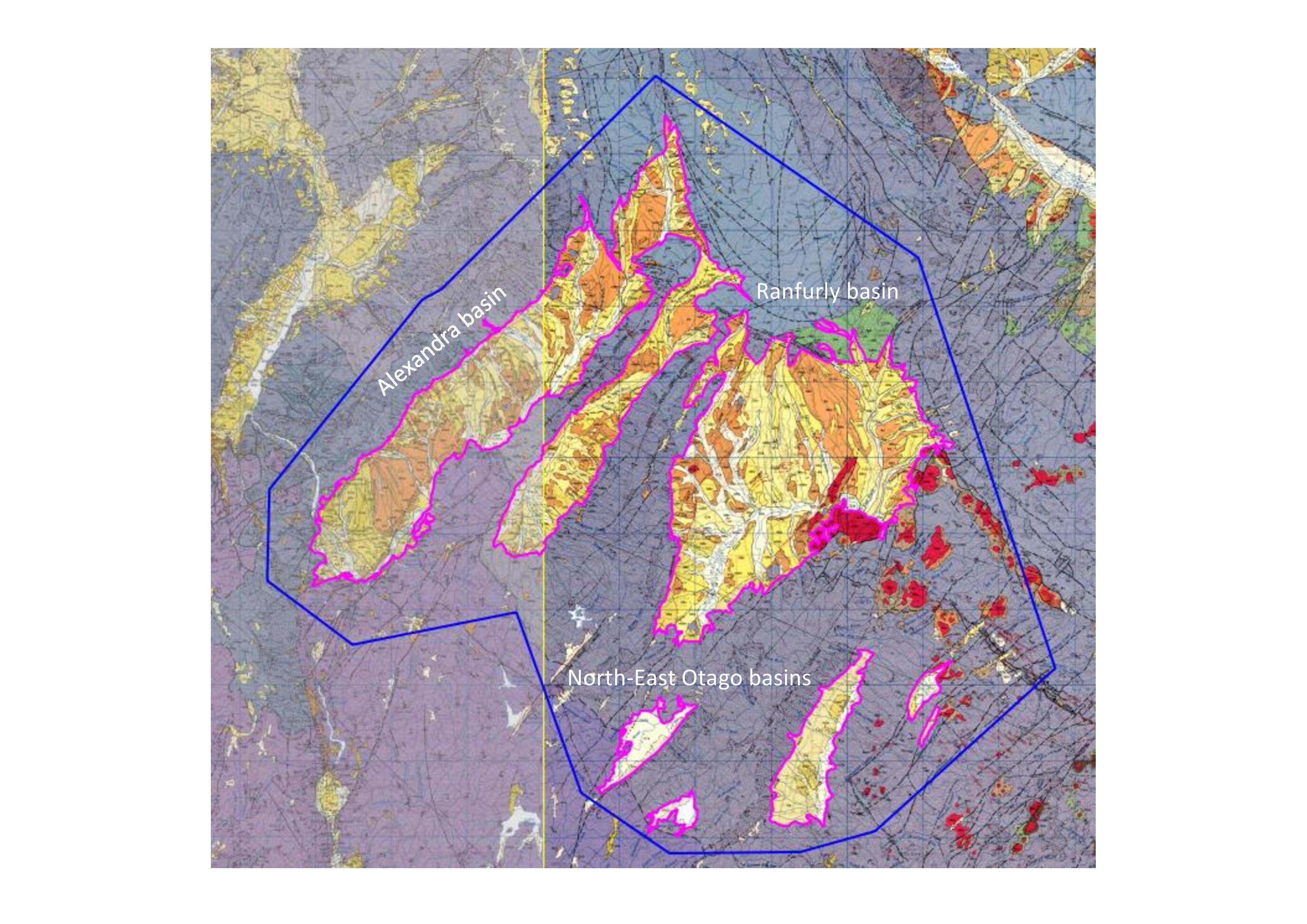
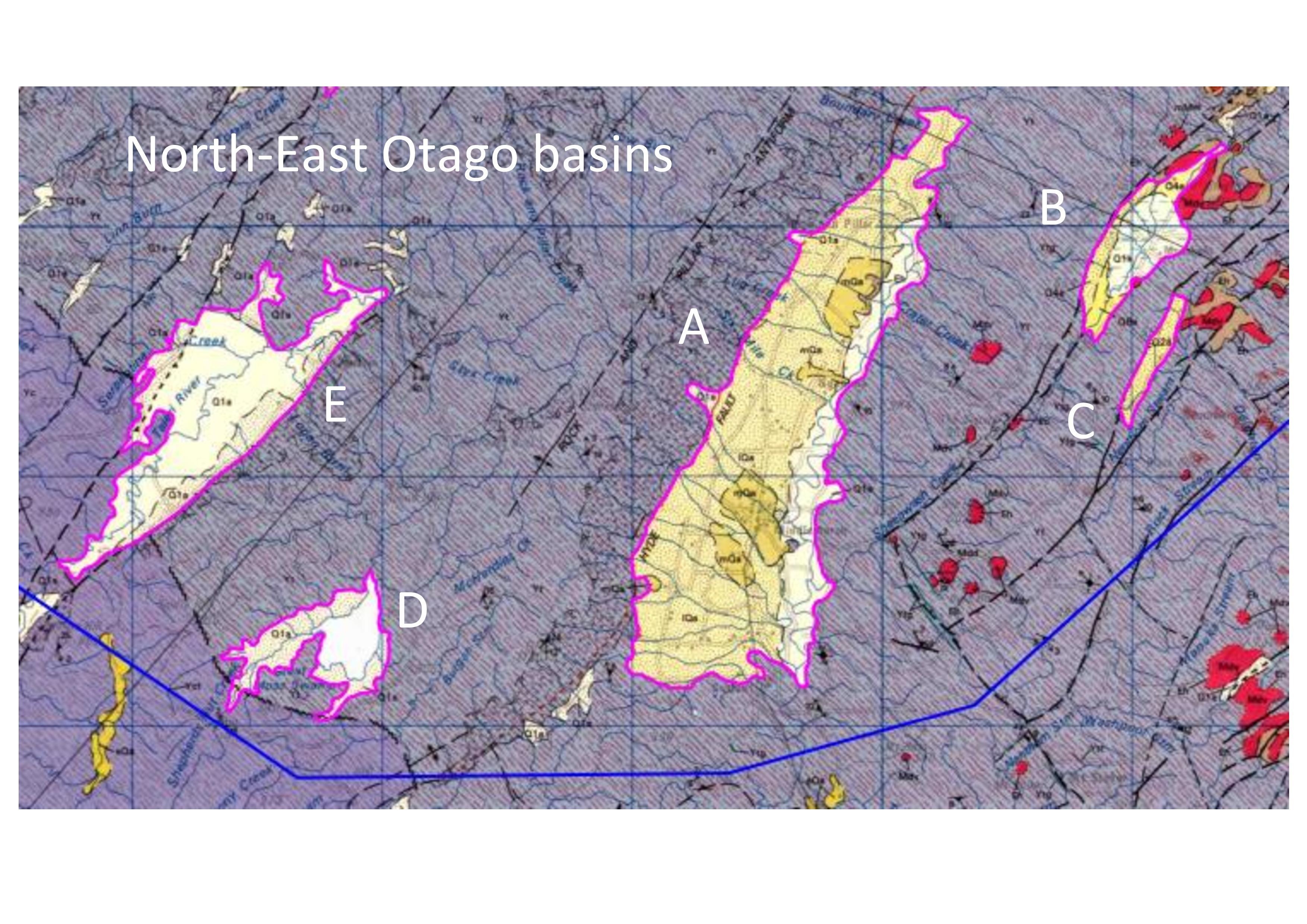
| 2.04+ | Cameron Douglas | 20p7 | Alexandra-Ranfurly | 1 | USER 2020 - Integrated |
|
2.04+ | Tim Tuckey | 20p7 | Wakatipu | 1 | USER 2020 - Integrated | |
| 2.04+ | Cameron Douglas | 20p8 | Waitaki River / Hakataramea | 1 | USER 2020 - integrated | (intersects with the boundary of the Cant VM – need to check boundry depth)
|
| 2.04+ | Cameron Douglas | 20p7 | Dunedin | 1 | USER 2020 - integrated | Model is currently implemented, but we need to update Port Chalmers. "Offshore" Inlets need to be modeled as a part of the basin going forward.
|
| 2.04+ | Cameron Douglas | 20p7 | Mosgiel/Waihola | 1 | USER 2020 - integrated | https://uceqeng.slack.com/archives/C015DE6C62W/p1594177119087700 Currently implemented as two separate basins (Mosgiel / Balclutha) but is joined by sedimentary rock. |
| 2.04+ | Cameron Douglas | 20p7 | Balclutha | 1 | USER 2020 - integrated | |
| 2.04+ | Tim | 20p7 | Murchison | 1 | USER 2020 - integrated |
Just the lime green areas. |
| 2.06+ | Tim Tuckey | 20p11 | Collingwood | 1 | USER 2020 - integrated | |
| 2.06+ | Tim Tuckey | 20p11 | Takaka | 1 | USER 2020 - integrated | |
| 2.06+ | Tim Tuckey | 20p11 | Karamea | 1 | USER 2020 - integrated | |
| 2.06+ | Tim Tuckey | 20p11 | Springs Junction | 1 | USER 2020 - integrated | |
| 2.06+ | Tim Tuckey | 20p11 | Motueka | 1 | USER 2020 - integrated |
(may not be identical to the implementation in the NZVM) |
| Grey River | 1 | |||||
| Westport | 1 | Have a fault through the basin that creates uplift. | ||||
| Haast | ||||||
| Hokitika | ||||||
| Franz | Needs input about how best to approach | |||||
| Fox | Needs input about how best to approach | |||||
| Southland | Needs input about how best to approach | |||||
NORTH ISLAND | ||||||
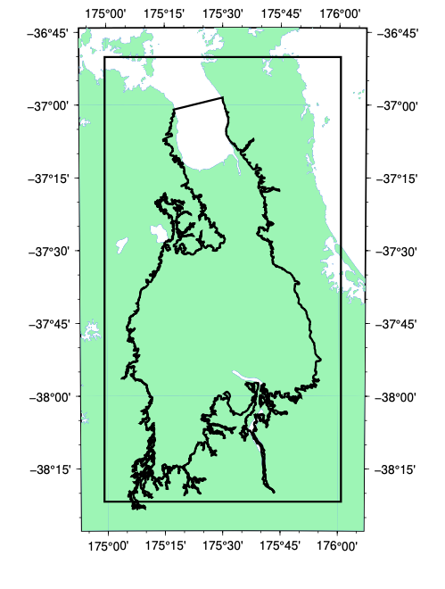
| 2.03+ | Andrew Stolte | 19p7 | Hauraki/Waikato | 1 | Integrated |
|
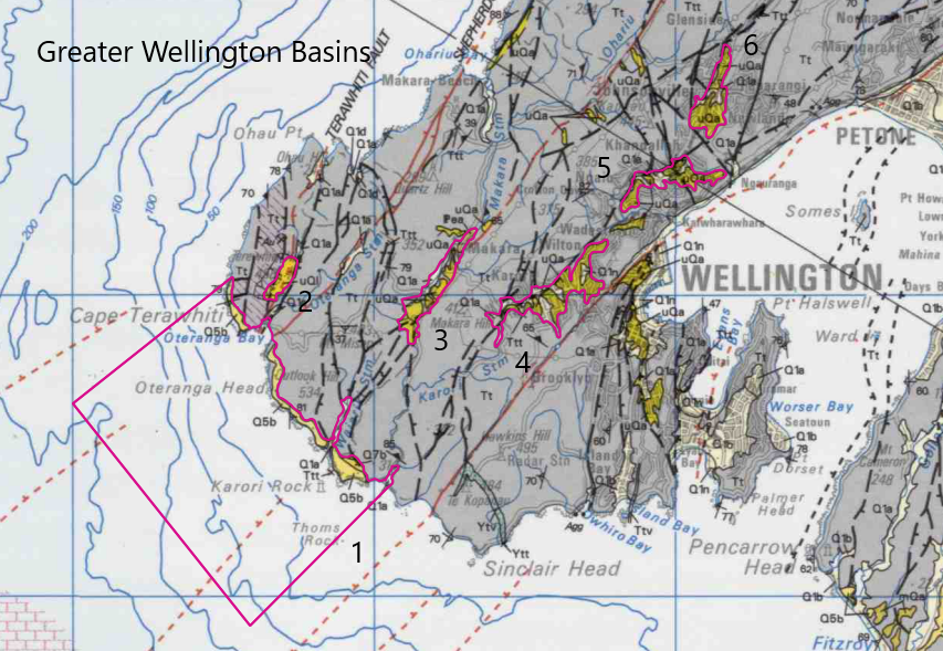
| 2.02+ | Robin Lee | Initial v19p1 updated 19p6 (Robin Lee) updated 21p8 (Hill 2022) | Wellington | 2 | Integrated |
|
| Tauranga | USER 2020 - NI - Partially done |
| ||||
| 2.07+ | William Lee | 21p7 | West Wellington Region Valleys | 1 | USER2021 - integrated |
|
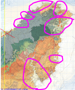
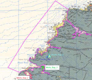
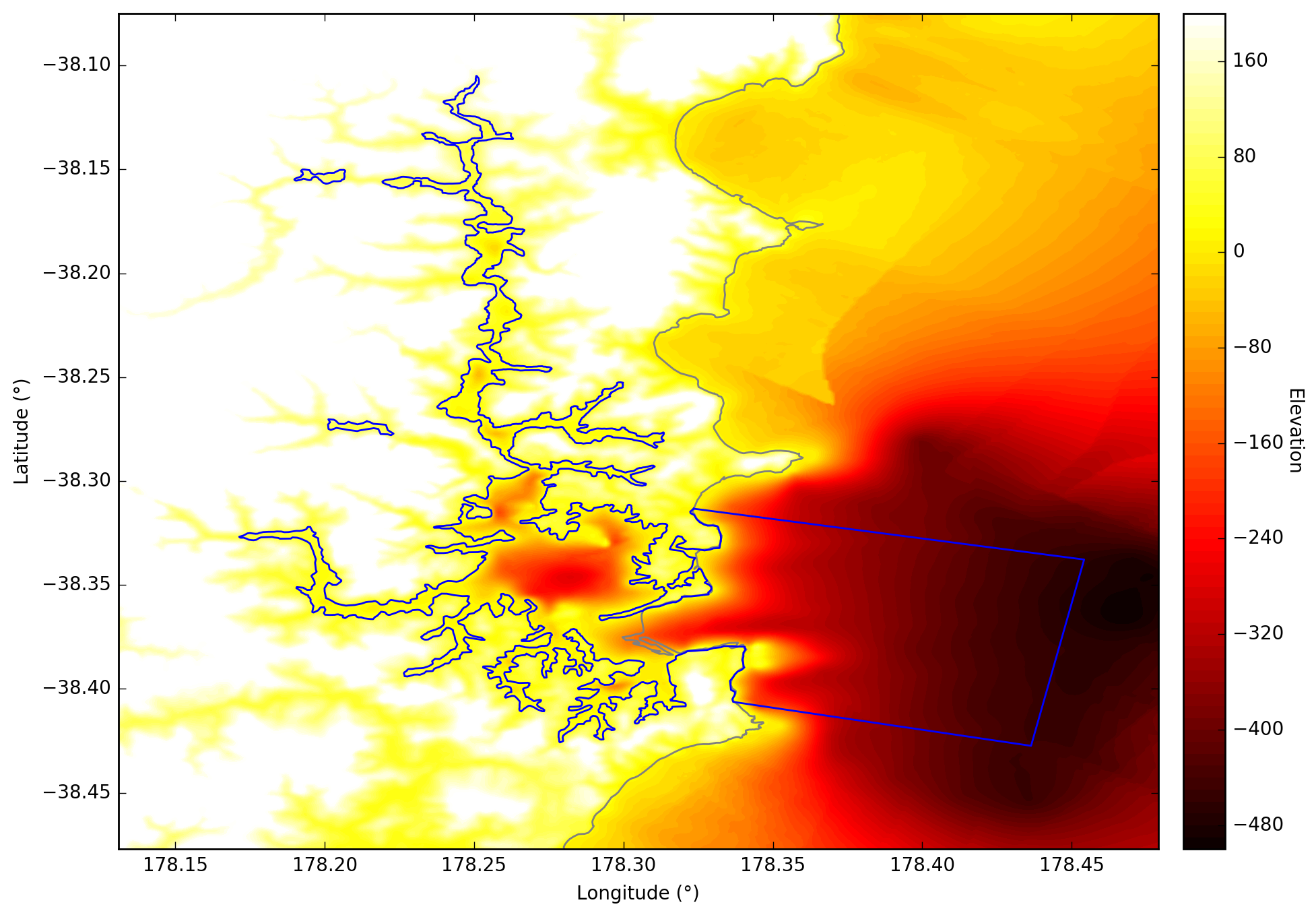
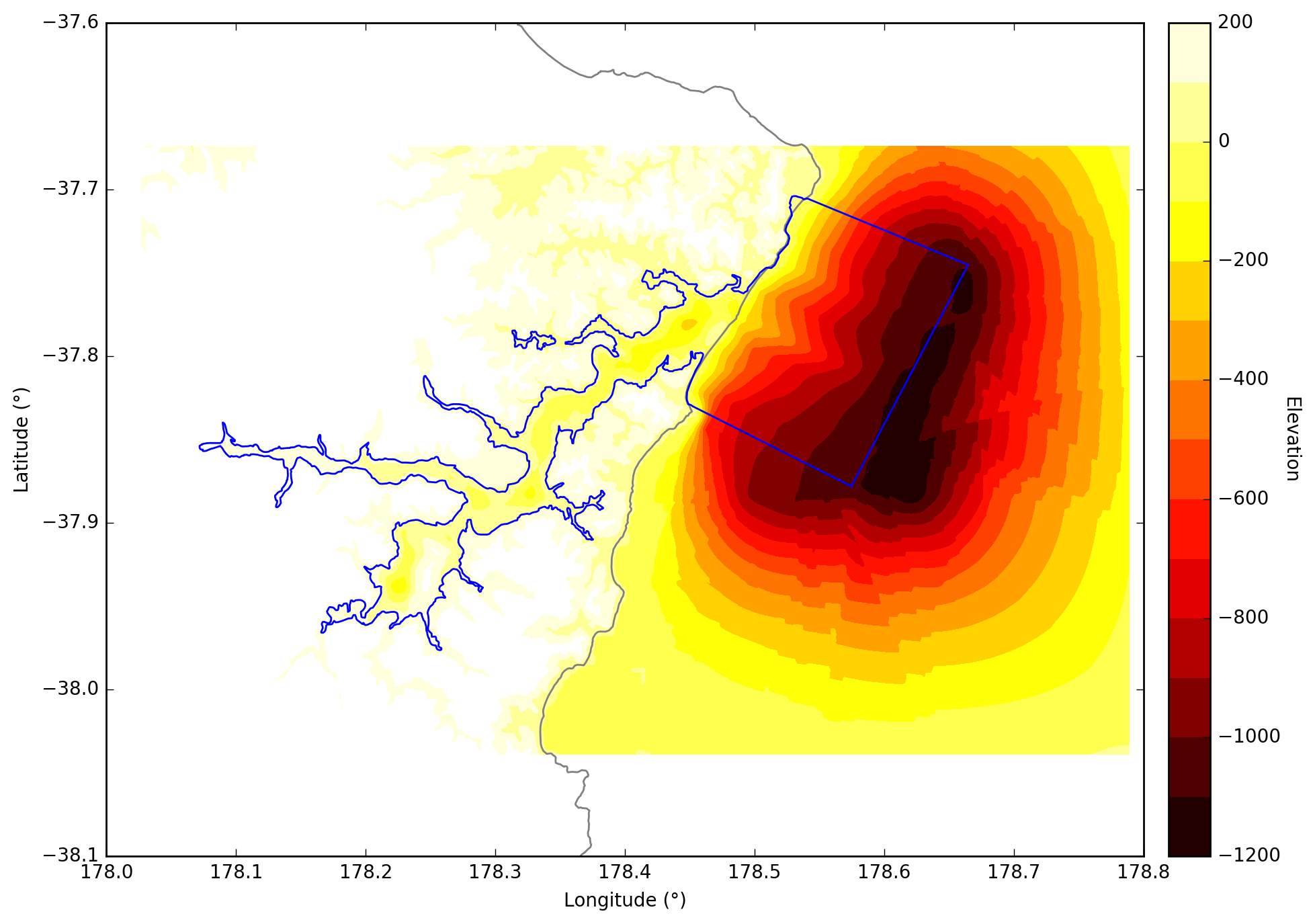
| 2.07+ (Motu River) | Cameron Davis + Emma Coumbe | 22p3 | East Cape | 1 | Motu Bay done - USER2022 Waiapu Bay done - USER2022 |
Motu River
Tolaga Bay
Waiapu Bay |
| 2.07+ | William Lee | Gisborne | 1 | USER 2021 - integrated |
| |
| Whakatane, Edgecumbe, and Murupara | USER 2020 - NI - Partially done |
| ||||
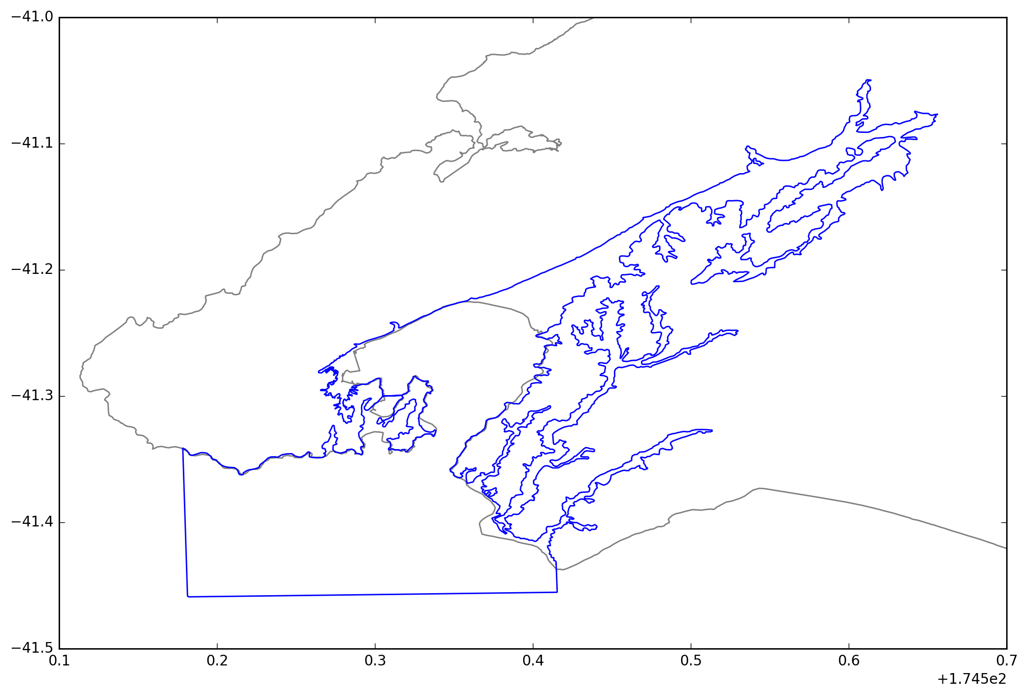
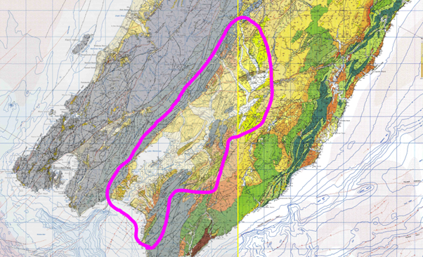
| 2.07+ | William Lee | 21p12 | Wairarapa | 1 | USER2021 - Integrated |
|
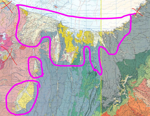
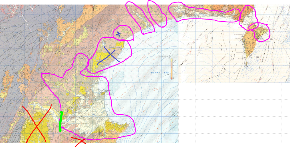
| 2.07+ | William Lee | Northern Hawkes Bay — Heretaunga Plains to Mahia | USER2021 - integrated |
The areas marked with black X's were either considered too shallow or sedimentary rock so weren't modelled as a basin. | ||
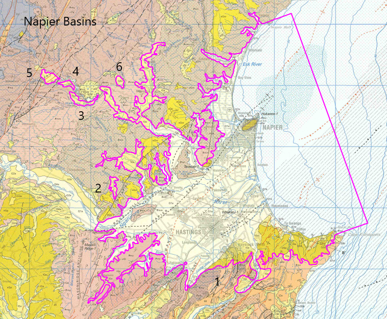
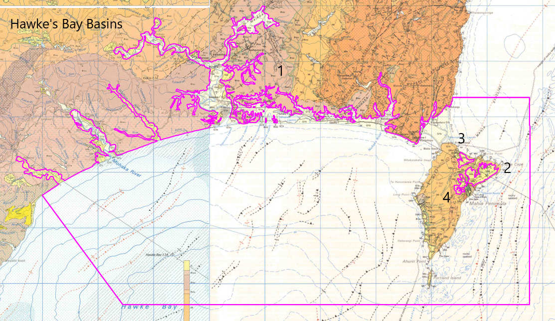
| 2.07+ | William Lee | Southern Hawkes Bay — Central Hawkes Bay and Tararua Districts | Looks like there are a couple more along the east coast to be done too |
| ||
| Rotorua and neighboring lakes |
| |||||
| Manawatu-Whanganui / Taranaki |
| |||||
| Auckland | ||||||